Study Finds Mangroves Gained Nearly 2,000 Square Kilometers After 2010
A Science analysis of Landsat imagery from 1984 to 2023 found global mangrove area increased by nearly 2,000 square kilometers after 2010, after earlier losses of almost 3,000 square kilometers. The rebound is led by Asia, Australia and South America, with two-thirds from colonization of new land and one-third from restoration. It matters because mangroves store large amounts of carbon, protect coasts and support fisheries, though losses continue in some regions.
Researchers using Landsat satellite imagery from 1984 to 2023 mapped changes in mangrove extent and canopy density worldwide. The analysis, led by environmental scientist Zhen Zhang at Tulane University, found a global rebound beginning around 2010, led by expansion in Asia, Australia and South America. The study reported in Science said the rebound followed decades of decline, with losses of nearly 3,000 square kilometers between 1984 and 2010 and gains of nearly 2,000 square kilometers after 2010.
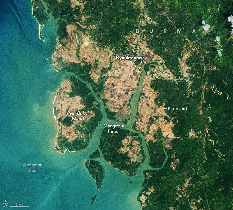
About two-thirds of the expansion came from mangroves colonizing new areas, while one-third came from restoration and regrowth in degraded forests. In Burma, mangrove area had fallen 28.6 percent from the 1980s to 2010 but grew about 10 percent afterward, according to the study. Satellite images from Palaw Township show regeneration in abandoned rice fields and tree planting near villages. Researchers linked the reversal to restoration after the 2004 Indian Ocean tsunami, legal protections and sedimentation that created mudflats.
The analysis also found many forests have denser canopies than in 2010, especially in South America, suggesting less degradation. It is also the first set of global mangrove maps covering such a long period. The methods note: this global remote-sensing study used four decades of Landsat observations, not ground plots, and its main limitation is that satellite maps can miss small local clearing and cannot fully prove why changes occurred.
Mangroves matter beyond forests: they can store up to four times as much carbon as taller inland tropical forests, shield coastal communities from erosion and storm surge, and provide nursery habitat for fish, shrimp and crabs. The rebound is uneven: losses in the Niger Delta reduced mangrove area in West and Central Africa, while warming allowed mangroves to move into previously too cold parts of the southeastern United States. The finding shows nature-based coastal protection and carbon storage are measurable at scale where restoration and legal protections have occurred.
Coastal communities, fisheries and climate programs are affected because mangroves reduce storm surge and erosion, support fish and shrimp, and store up to four times as much carbon as taller inland tropical forests. The rebound offers satellite-verified evidence that restoration and protection can deliver measurable benefits, while regional losses show the gains are uneven.
Sources (1)
- [1]Original source(https://science.nasa.gov/earth/earth-observatory/a-global-rebound-for-mangroves/)