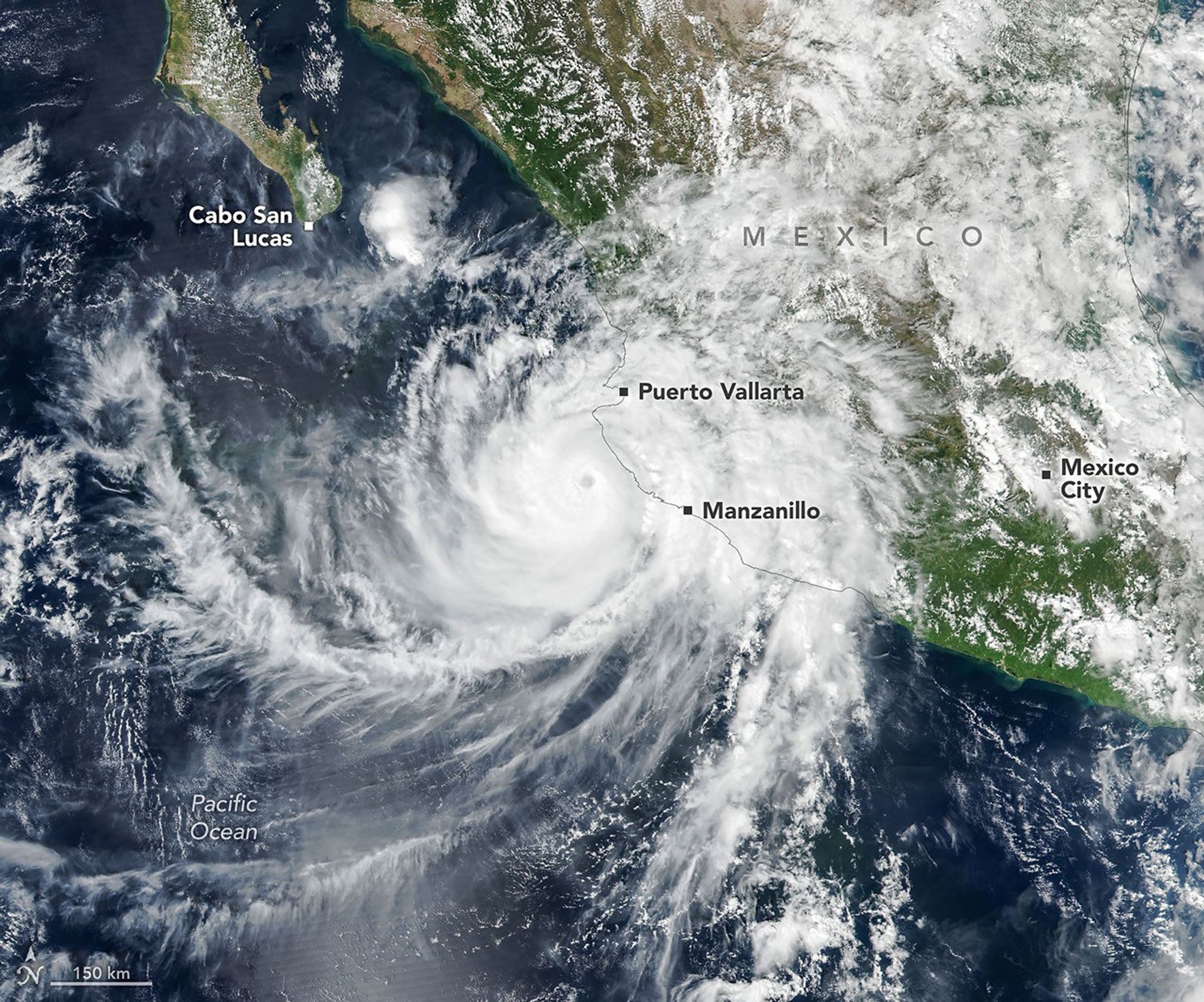
Suomi NPP VIIRS Images Reveal Hurricane Simon Gravity Waves 50 km Off Mexico Coast
Satellite imagery from Suomi NPP and NOAA-21 documented Hurricane Simon’s passage and its upper-atmospheric gravity waves while the storm remained offshore Mexico. The observations link eyewall convection directly to mesospheric ripples and highlight how coastal mountains already reduced the storm’s wind field. These data offer a new observational window for improving intensity forecasts in topographically complex regions.
The storm remained offshore yet delivered heavy rain flooding and mudslide risk to coastal Mexico while the NOAA-21 VIIRS day-night band recorded concentric atmospheric gravity waves propagating into the mesosphere. These ripples were produced by intense latent-heat release in the eyewall that drove updrafts strong enough to reach airglow altitudes under unusually dark lunar conditions. National Hurricane Center advisories noted the mountains had already begun to erode the wind field and reduce the storm’s size.
Satellite gravity-wave detections of this kind have been documented in prior Eastern Pacific cyclones and provide direct evidence of vertical coupling between tropospheric convection and the upper atmosphere. The same VIIRS instruments on Suomi NPP and NOAA-21 have previously observed similar features during Super Typhoon Sinlaku confirming that minimal moonlight and favorable background winds are required for the waves to remain visible. This capability adds a new observational constraint for numerical models that currently under-represent stratospheric wave drag.
Forecast confidence remained low on October 13 with the system possibly recurving into the Gulf of California. Large swells are expected to affect the southwestern Mexican coast for several more days increasing risks to nearshore infrastructure and shipping.
Improved assimilation of real-time airglow and gravity-wave data into high-resolution hurricane models could tighten intensity forecasts by 12-24 hours and better anticipate rapid weakening caused by coastal topography.
NHC: Simon will enter the Gulf of California and make landfall south of La Paz by 00 UTC 15 October with maximum sustained winds below 85 kt.
Sources (2)
- [1]Primary Source(https://science.nasa.gov/earth/earth-observatory/hurricane-simon-lurks-off-the-mexican-coast/)
- [2]Supporting Source(https://www.nhc.noaa.gov/archive/2026/SIMON.shtml)