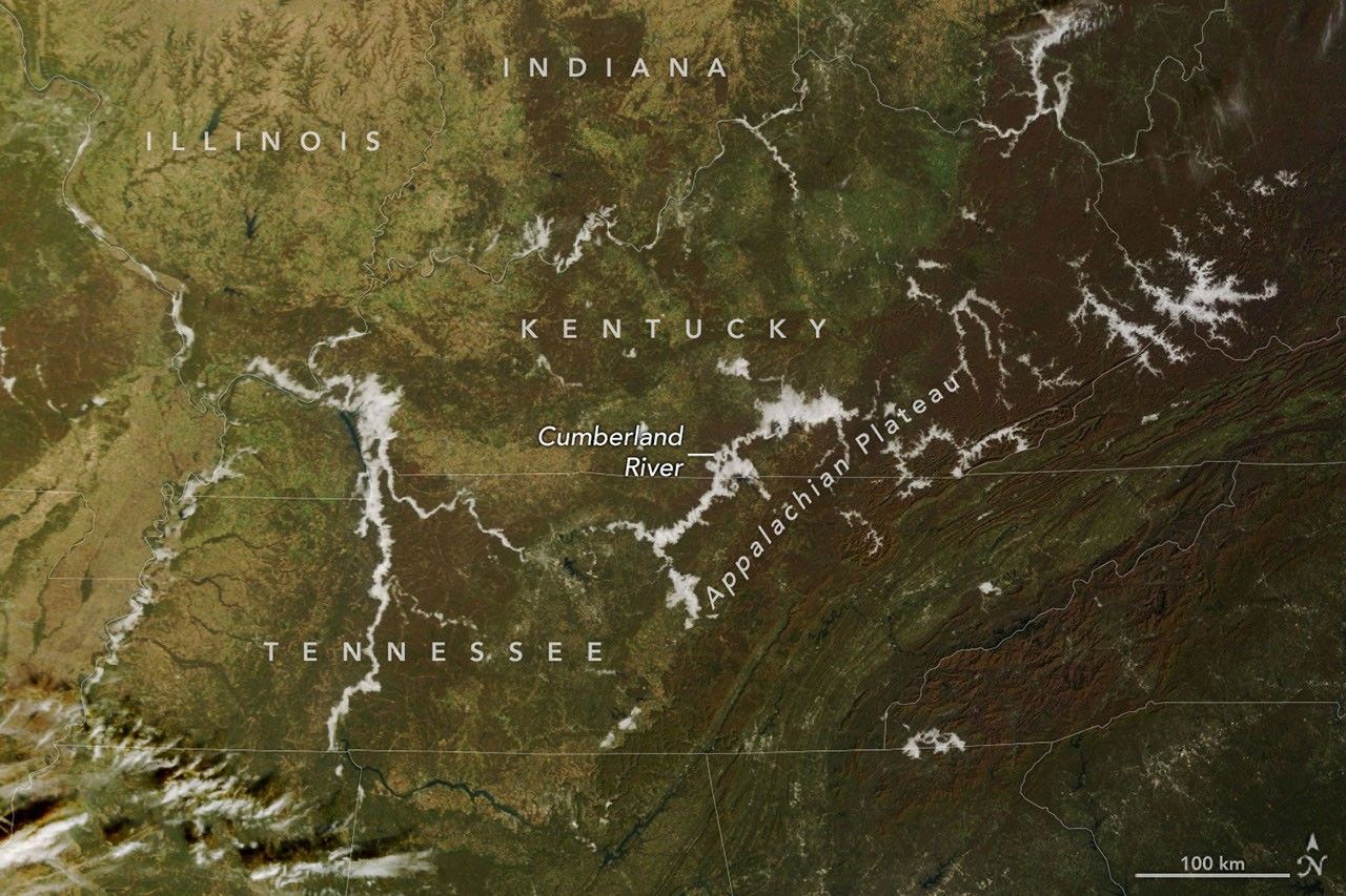
Nov. 8 satellite pair shows Appalachian valley fog, not a climate or ocean-snow signal
Two NASA and NOAA satellite images document ordinary November radiation fog in Appalachian and Cumberland valleys, gone by afternoon. The scenes are not a study of climate forcing or ocean marine snow, which is a separate deep-sea carbon process. Hazard claims need ground visibility data these images do not provide.
NASA Earth Observatory published a November 10, 2026 Image of the Day built from two scenes on November 8. Terra’s MODIS, in natural color, showed white low clouds tracing branching valleys in eastern Kentucky and southwestern West Virginia and along the Cumberland River and its reservoirs in Tennessee and Kentucky. That afternoon, VIIRS on NOAA-21, in false color, showed the clouds dissipated and water and autumn vegetation exposed. Kathryn Hansen’s caption is a seasonal explainer. The National Weather Service reported morning temperatures in the 30s Fahrenheit, locally dense valley fog, and earlier-week advisories for hazardous travel.
The clouds are radiation fog, a ground-hugging cloud, not a storm and not marine snow. Longer nights let the surface radiate heat; air cools to the dew point and vapor condenses. Denser cold air drains downslope and pools in valleys, while rivers add moisture. Morning MODIS and afternoon VIIRS show presence and burn-off, not depth, droplet size, or visibility. Methods note: this is a two-image case observation with no sample of days and no ground transects, so it cannot measure how dense or dangerous the fog was.
What a climate-and-ocean-snow frame gets wrong is the category. Marine snow is sinking plankton debris, fecal pellets, and mucus that feeds the biological pump; reviews such as Turner’s describe a carbon flux these land imagers do not see. Appalachian valley fog is boundary-layer weather. It can hide roads and river bends. Warmer nights could change how often air hits the dew point, but this pair has no trend, no emissions number, and no causal test. NASA’s own 2018 valley-fog note already described the same pooling.
Stronger evidence would pair the overpass with visibility sensors, temperature and humidity profiles, and crash or delay logs, repeated across autumns. Forecasters already treat clear, calm nights after cool mornings as fog setups. Through late November 2026, similar fog should form and usually burn off after sunrise unless added moisture or a stronger inversion holds it. The number that matters for travelers is reported visibility, not the color of a browse image.
Sources (3)
- [1]Autumn Mornings Bring Valley Fog(https://science.nasa.gov/earth/earth-observatory/autumn-mornings-bring-valley-fog/)
- [2]NOAA: What's the Difference Between Fog and Clouds?(https://www.noaa.gov/education/resource-collections/weather-atmosphere/fog)
- [3]Turner, Zooplankton fecal pellets, marine snow, phytodetritus and the ocean’s biological pump(https://doi.org/10.1016/j.pocean.2014.08.005)