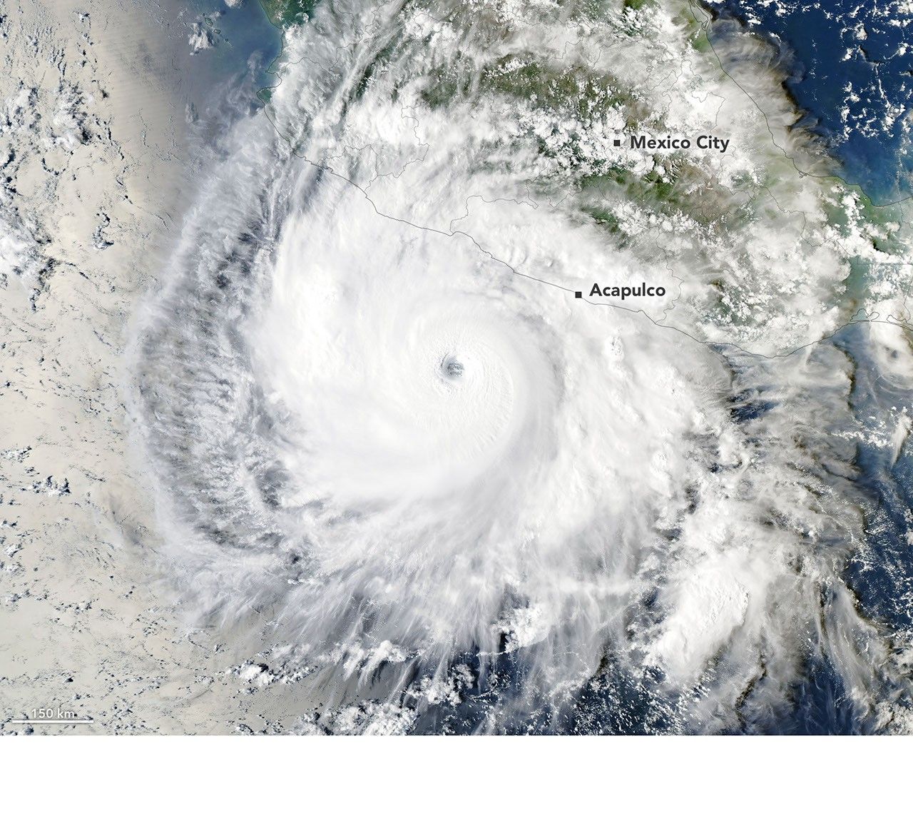
Hurricane Polo Sets Eastern Pacific Record with 90-Knot Intensification in 24 Hours
Hurricane Polo achieved record rapid intensification driven by anomalously warm ocean layers and favorable atmospheric conditions. The event underscores how deeper ocean heat content sustains extreme strengthening beyond surface measurements alone. Improved subsurface monitoring and model resolution are required to anticipate future cases with comparable speed.
Polo formed off Mexico's Pacific coast in mid-September 2026 and reached tropical storm status within two days. NASA Aqua MODIS imagery and NOAA Hurricane Hunter data captured the subsequent explosive phase, with winds climbing to 180 mph under conditions of minimal shear, 32°C sea surface temperatures, and elevated ocean heat content at depth. The storm's eyewall replacement cycle later reduced it to Category 4.
Rapid intensification events like Polo's are becoming more frequent in the eastern Pacific as anthropogenic warming raises baseline ocean temperatures and atmospheric instability. Comparable cases such as Hurricane Patricia in 2015 demonstrated that sustained warm anomalies deeper than 50 meters allow storms to resist the usual cooling from upwelling. This pattern aligns with findings from the 2023 BAMS State of the Climate report showing a 15% rise in eastern Pacific rapid intensification since 2000.
The MUR SST dataset reveals that the 2-3°C anomaly Polo encountered was not isolated but part of a broader warm pool extending southwest of Acapulco. Weak upper-level winds and strong outflow further enabled the storm to maintain its structure despite the eyewall cycle. Continued monitoring of subsurface heat will determine whether similar events recur before the 2026 season ends.
Future seasons will test whether agencies can translate these observations into earlier warnings. High-resolution coupled ocean-atmosphere models now running at GMAO suggest that storms reaching Category 5 within 48 hours of depression formation will increase if September SST anomalies remain above 2°C.
GMAO: Eastern Pacific rapid intensification events exceeding 60 knots in 24 hours will occur at least twice per season if September SST anomalies stay above +2.0°C through 2028.
Sources (3)
- [1]Primary Source(https://science.nasa.gov/earth/earth-observatory/explosive-intensification-for-hurricane-polo/)
- [2]Supporting Source(https://www.nhc.noaa.gov/data/tcr/EP162026_Polo.pdf)
- [3]Supporting Source(https://www.ametsoc.org/ams/index.cfm/publications/bulletin-of-the-american-meteorological-society-bams/state-of-the-climate/)