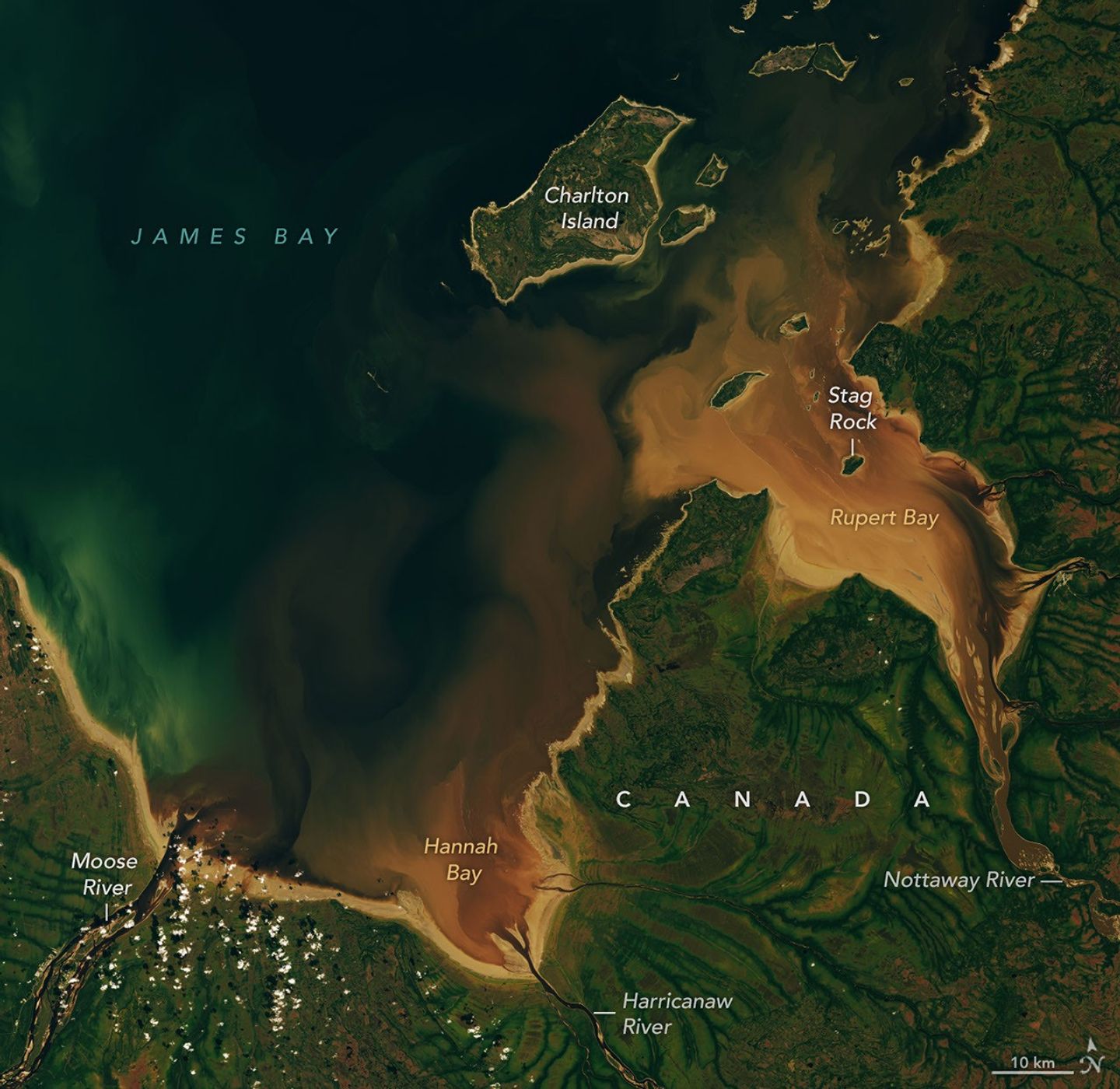
Landsat 9 Imagery Reveals CDOM Export from Boreal Wetlands into James Bay Mudflats
Landsat 9 documented brown-water plumes in Rupert Bay driven by CDOM and sediment from boreal catchments. The observation highlights carbon export from peatlands and ongoing landscape adjustment from postglacial rebound. Stronger evidence would require time-series analysis linking CDOM trends to measurable climate or land-use variables.
Future monitoring could test whether accelerating permafrost thaw or altered precipitation regimes increase CDOM loading beyond the 2026 baseline. Integration with in-situ optical sensors and higher-frequency Sentinel-2 data would strengthen attribution of interannual variability to specific climatic or land-cover drivers. Such records matter for coastal ecosystems because elevated CDOM can suppress phytoplankton productivity and alter food-web dynamics that support migratory waterfowl and fisheries.
HELIX: Landsat-derived CDOM absorption at 440 nm in Rupert Bay will exceed the September 2026 value by at least 15 percent in any September observation between 2028 and 2032.
Sources (3)
- [1]Primary Source(https://science.nasa.gov/earth/earth-observatory/the-beaver-brown-waters-of-rupert-bay/)
- [2]Supporting Source(https://doi.org/10.1016/j.csr.2019.03.004)
- [3]Supporting Source(https://doi.org/10.1029/2020JG005698)