Satellite Data Confirm Persistent Lava Lake at Remote Mount Michael
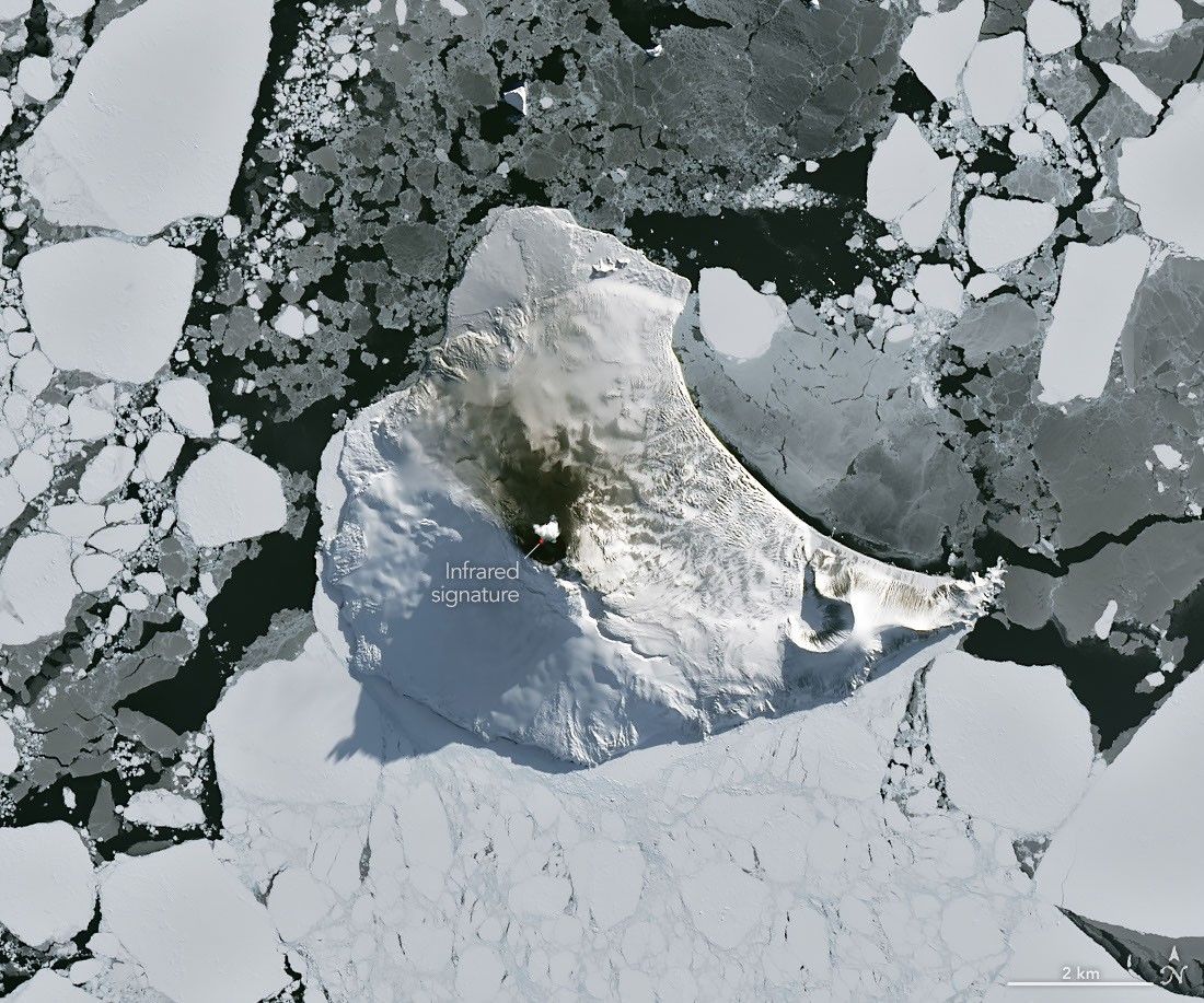
Persistent lava lake activity at Mount Michael was reconfirmed by Landsat 8 thermal imaging in August 2026. Multi-decadal satellite records and gas measurements show the remote volcano has maintained low-level eruptions and degassing for years. The finding underscores reliance on space-based sensors for monitoring volcanoes in the uninhabited South Sandwich Islands.
The image combined natural-color visible bands with OLI bands 7-6-5 to highlight thermal emission, showing both the lava lake and a volcanic plume plus darkened snow on northern slopes. Researchers had already used 30 years of Landsat, Sentinel-2 and ASTER thermal anomalies plus MODIS and VIIRS hot-spot detections to establish that Mount Michael belongs to the small group of volcanoes hosting long-lived lava lakes, alongside Kīlauea, Nyamulagira and Erta Ale. MIROVA near-real-time monitoring and Aura SO2 measurements further indicate low-intensity activity and gas emissions have continued for years. Because the island lies 350 km from the nearest inhabited land, satellite observations remain the only practical monitoring method. The same atmospheric conditions that cleared the view also generated ship-wake wave clouds downwind of the 843 m peak and a possible SO2-induced cloud track visible in Aqua false-color data.
MIROVA: thermal anomaly counts at Mount Michael will remain above 5 detections per month through December 2026
Sources (2)
- [1]Primary Source(https://science.nasa.gov/earth/earth-observatory/a-bright-spot-at-mount-michael/)
- [2]Supporting Source(https://www.sciencedirect.com/science/article/pii/S0377027319300693)