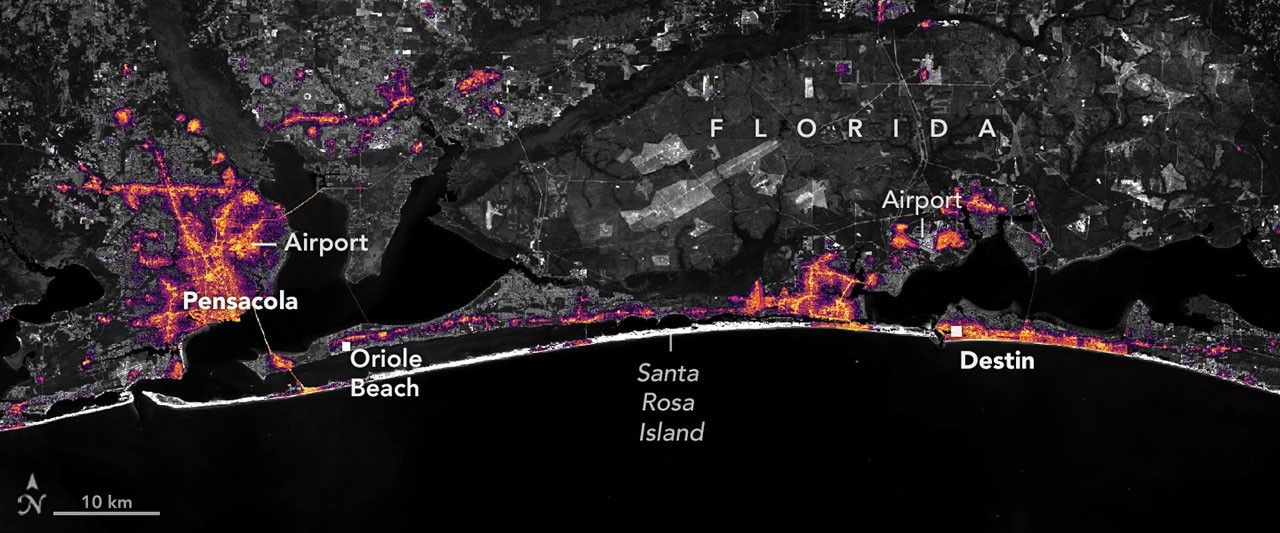
NASA Black Marble HD Maps Isaias Power Outages at Block Level in Florida Panhandle
High-resolution nighttime lights from NOAA-20 VIIRS captured Isaias-induced outages and five-day recovery along the Florida Gulf Coast. The data complement FEMA and utility reports by revealing spatial patterns at finer scales than standard Black Marble products. Persistent lights at key facilities suggest backup systems that merit further ground validation.
VIIRS day-night band data processed through Black Marble HD showed sharp light loss west of the eye track on October 11, with pockets of persistence at the airport, Pensacola Christian College, and downtown cores. The product corrects for lunar phase, atmosphere, and stray light at 30 m resolution, allowing block-scale outage detection that ground reports miss. Recovery imagery from October 12 and 14 documented progressive restoration, highlighting infrastructure resilience differences along the corridor.
NASA Disasters Program: Black Marble HD outage maps will be delivered to FEMA within 48 hours for at least three Atlantic landfalls in 2027.
Sources (3)
- [1]Primary Source(https://science.nasa.gov/earth/earth-observatory/isaias-dims-the-gulf-coast/)
- [2]Supporting Source(https://blackmarble.gsfc.nasa.gov/)
- [3]Supporting Source(https://www.nesdis.noaa.gov/news/hurricane-isaias-power-outages-florida)